Symbols and buttons in the navigation system
The map in the centre display shows symbols and colours providing information about various roads and the area around the car and the route. A tool bar with different buttons for different settings is to the left.
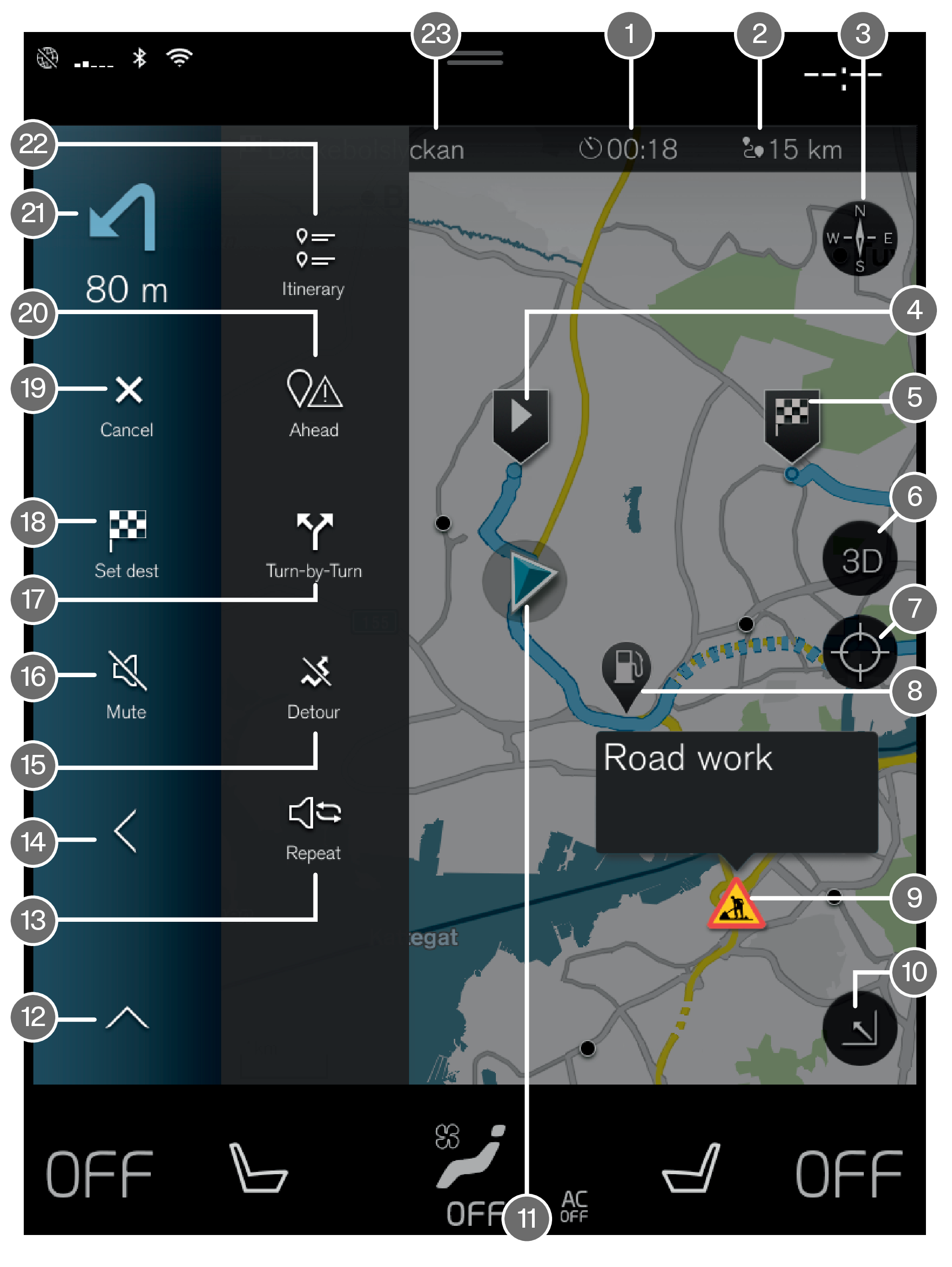
| Symbols and buttons on the map | |
 | Arrival time/remaining travel time |
 | Distance to destination |
 | Compass/changes between north and travel direction up |
 | Starting |
 | Destination/final destination |
 | Changes map display between 2D and 3D |
 | Reset the map to follow the car |
 | Point of interest (POI1) |
 | Traffic information |
 | Minimises (expanded view) or maximises the map image (full screen) |
 | Car on planned route |
 | Minimises the tools field |
 | Repeat the current voice guidance |
 | Minimises the tools field |
 | Calculate detour |
 | Voice guidance temporarily On/Off |
 | Shows list with the itinerary's guidance points |
 | Specifying destinations/intermediate destinations |
 | Cancels guidance |
 | Shows list of the itinerary's points of interest (POI1) and traffic information |
 | Next manoeuvre |
 | Itinerary and Alternative route |
 | Destination/final destination |